
Sacred travels once a year
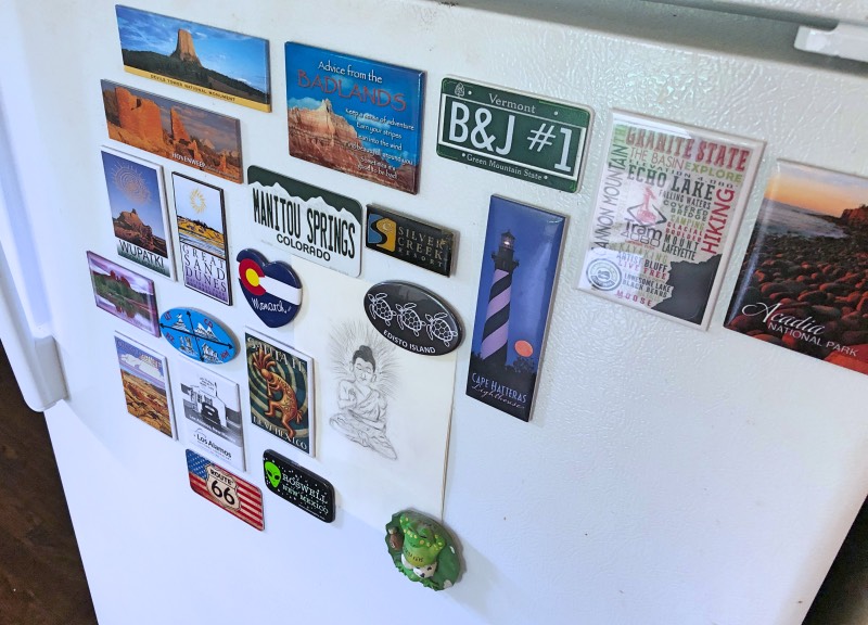
Hello friends! Sacred travels: Four Corners – the highlight of my June. I am a huge advocate of traveling somewhere new at least once per year. More than that, I lead a spiritual life and I have been trying to visit sacred places in all 50 states for the past three summers. I’ve driven through many states – 14 in the northeast, through the mid-section of the US, and haven’t quite made it to the west coast. I typically collect a magnet when I’ve stopped at a sacred spot (if I can find one) and add it to my refrigerator as a daily reminder of my mission to seek out new and special places in the US…and beyond.
Watch the video
I created a video of my travels using video footage of my trip. While some of the content mirrors what’s in this post, there are lots of extras: I inserted lots of extra photos, thoughts on feeling spirit, and more. It’s a bit like watching a documentary of the Four Corners region.
The “sort of” planned trip
On my most recent trip, my husband and I headed out to the southwestern US, with a focus on the Four Corners area. We always have an idea of areas we’d like to see and usually plan out a rough idea of the places we’ll visit and when. But then we leave it up to how we feel, whether we think we can deal with weather conditions, traffic, and if there’s a place we can find to camp, and change plans if necessary. This trip was no exception.
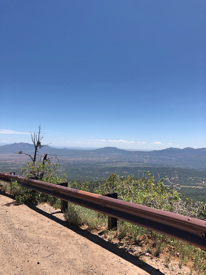
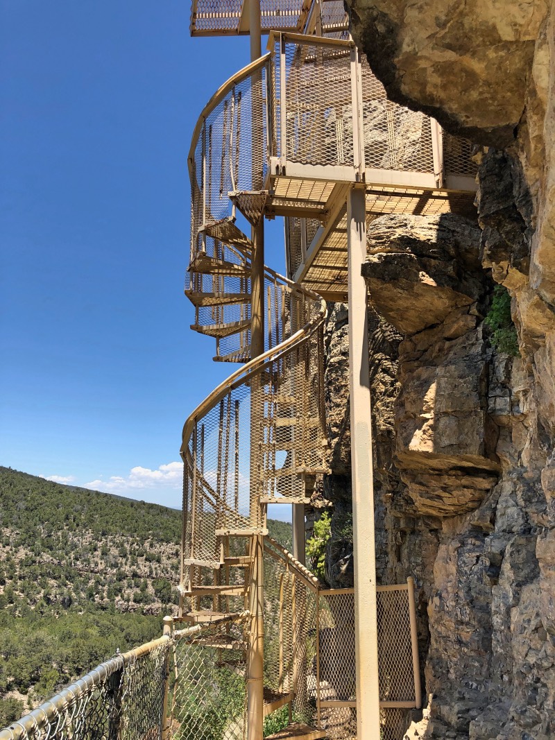
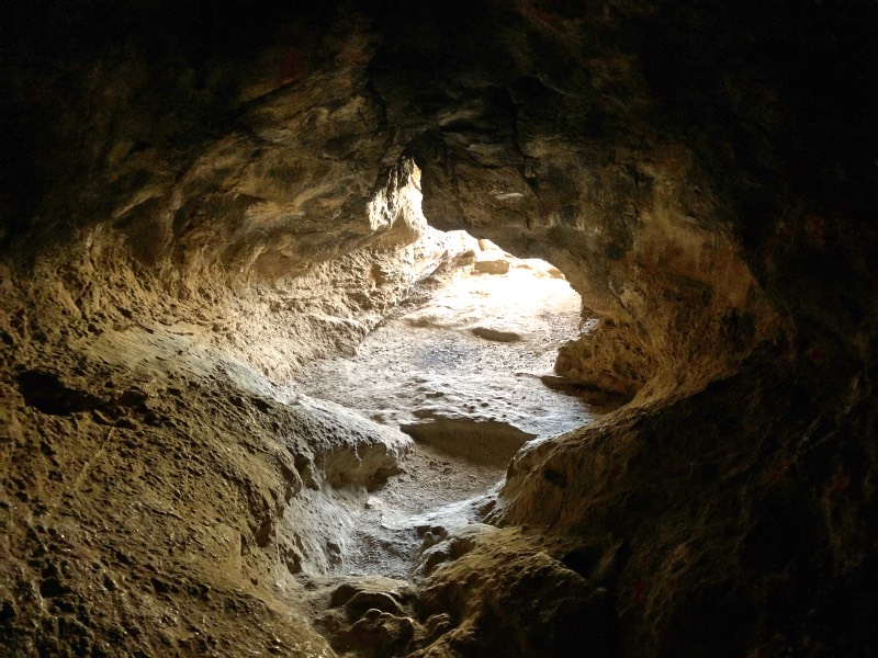
An unplanned stop at Cibola National Forest
After we left North Carolina, we headed west. The first night entailed staying at a free campsite not far from Little Rock, AR. On our cross-country travels, we’d actually stayed there before.
Sacred travels to Chaco Canyon
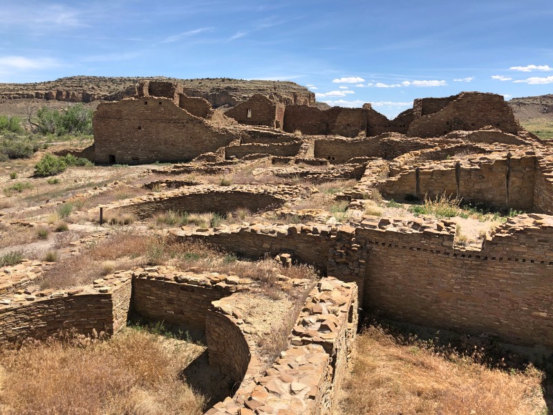
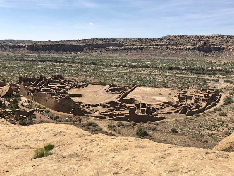
Our next stop was in the desert land of Chaco. A place that makes you “earn” your stay. You have to compensate for the heat by drinking a gallon of water a day (no joke!) and the sun is intense – there is little shade. The road into Chaco is a dirt road, as well. It’s slow-going, but once you get to the park, you’re met with great houses and vistas that render you speechless. But the efforts are worth it. You enter a place that is so silent, you can almost hear the echoes of voices from a millennia ago. The rock formations reach for the sky, and the dwellings and structures demonstrate human ingenuity at its finest in an era of no advanced or digital technology.
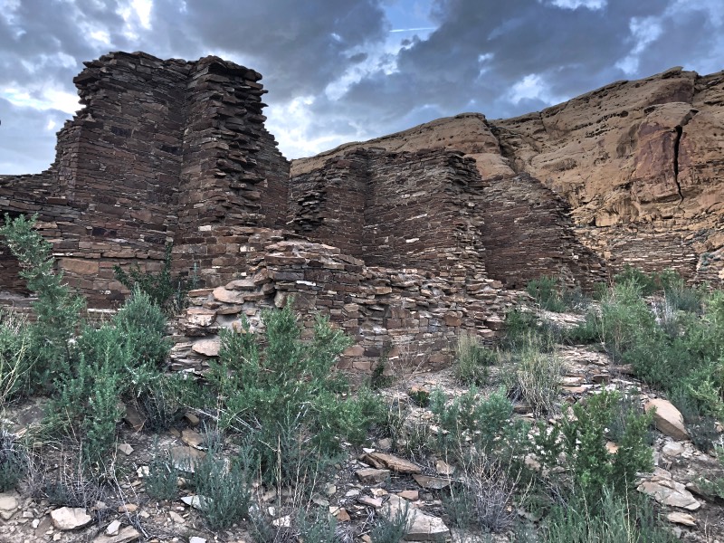
Wijiji Trail
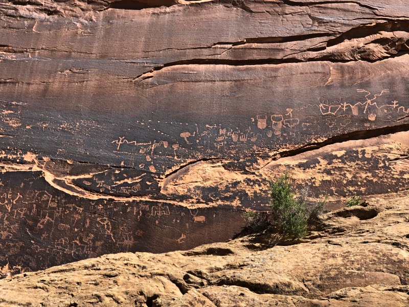
The first evening there, I found an overlook trail. I also discovered a great morning meditation spot. The next day I visited Hungo Pavi, Chetro Ketl, and Pueblo Bonito in the morning. In the early afternoon, I then visited Kin Kletso, Pueblo del Arroyo and Casa Rinconada. With the heat of the sun, in the afternoon, I napped and spent time reading under my sun shade. Later in the day, I hiked a trail called “Wijiji” that took me to another settlement and the opportunity to see some faint images of rock art.
My favorite spiritual spots
Pueblo Bonito – the largest set of ruins and where the most people go, was massive, filled with kivas and various utilitarian rooms. All the while, I kept thinking about why the Chacoans would settle in this high desert, and build a trade center there. Because of the size of the settlement and foot traffic, I didn’t get quite the “spiritual” feeling I was looking for. Just before visiting Pueblo Bonito, however, I was able to get some “solo time” at the great kiva at Chetro Ketl. There, I got a special feeling of sacredness.
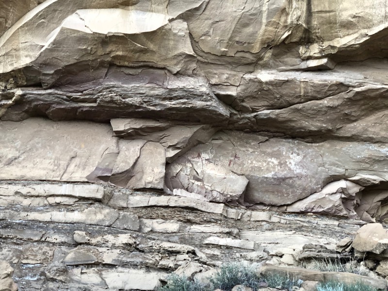
Later in the day, as I walked along the Wijiji trail in an apparent valley, I would sense that familiar feeling of sacred energy. The sun was setting and because you cannot get there by car (I don’t think), it is much less traveled. The Chacoans built Wijiji later than Pueblo Bonito. The rock work was different, but it felt more special somehow than the more-traveled areas. Perhaps it was the silence – not even the sound of birds – or the relative remoteness that made it special there. Perhaps it was the pink gold of the setting sun upon the backdrop of rocks, casting a soft light onto the Wijiji great house. Maybe it was knowing that there was rock art, whose face bore witness to the stories of a people who figured out how to survive in a desert landscape so long ago. Whatever it was, I was awed. (see photo above)
Pueblo Alto – Ruins and Trail
My next favorite spot was atop the mesa overlooking Pueblo Bonito. I’d arrived there after climbing several hundred feet – in a very short span – up the Pueblo Alto Trail. I could see Fajada Butte nearby, the Huerfano Mountains in the distance, as well as other landmarks even farther away. Those distant places were where the ancient Chacoans could signal their kin to come from great distances to engage in ceremony and commerce at Pueblo Bonito.
From Chaco to the Four Corners
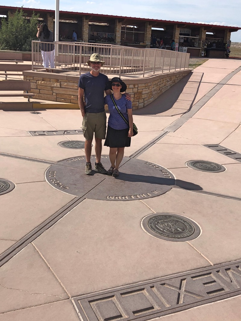
After visiting Chaco, weren’t originally going to “stand on the corners of four states” but it was only five miles out of our way. In the end, it was more of a novelty than anything else, but I’m still glad we stopped. Surrounding the spot where Colorado, Utah, Arizona and New Mexico intersect are market tables where people set up their crafts and jewelry to sell. I felt closed off to this at first because I hadn’t come to stand on the Four Corners to then pick up a “touristy souvenir.” But then I realized that many of the people who were running the booths were from the nearby Navajo reservation and I thought that it might be good to support their work. I found my magnet signifying my visit to the Four Corners.
Karen Pete – A Navajo artist and elder
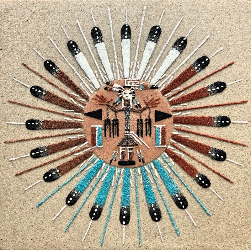
And then I happened upon a tiny Navajo woman who had what I personally recognized to be “wisdom lines” on her bronzed face. I made eye contact and she immediately drew me in with a demonstration of her sand painting art. This elder mesmerized my sensibilities in showing me how to create a sand painting.
I asked her what she would recommend to someone on a spiritual journey to buy. She guided me to a painting she’d completed and told a story of healing feathers in the four cardinal directions, the guiding Sun and Eagle, and the Pollen Boy standing in the center – basically they are guideposts along the journey and if I remain true to my heart, I will be guided in the right direction. She wrote the story on the back of the painting and signed her name, Karen Pete. I *so* wish she had a website so you could see her beautiful paintings – done with such soul and spirit. I was moved by her wisdom.
An unplanned turn toward…Utah
While in the Four Corners area, we asked several folks from the Navajo reservation about Monument Valley. You know, that place you’ve seen in the movies that looks like you’re on another planet. No one could tell us if there was still availability for camping there, if they had room, if there was access to water. The sun had beat down on us at Chaco, such that we decided that perhaps we’d visit Monument Valley the next day after finding a camp spot somewhere nearby, preferably with access to water. It’s amazing how grateful you get for water when it seems to evaporate out of the thin air at the high altitude, and how much you realize you depend on it…for life.
Sacred travels to the north
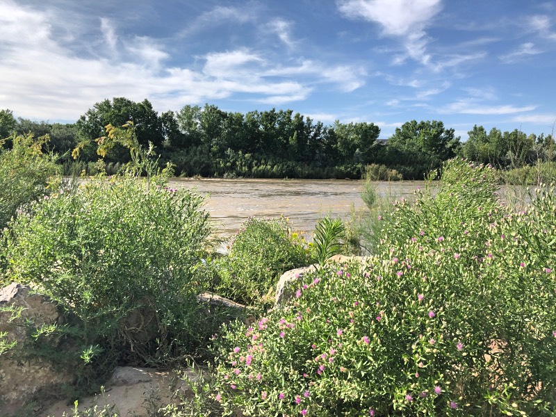
We turned north toward some different camping possibilites. Thirty miles later we crossed the San Juan River and saw a blue canopy, followed by a sign for the turn-off for Sand Island Recreation Area. We turned in on the spot “just to look” – we had no idea what that place was. As fate would have it, there was a camp spot right on the river. Before paying to stay, we mapped out a new plan: instead of Monument Valley, we realized how close we were to some other treasured places and re-worked this part of our trip.
Sand Island Recreation Area
Due to all the runoff, the San Juan River was swollen with water. I later learned that Sand Island Rec Area was a hub for white water rafters to “put in” the river. The river was high enough that I remember thinking, “hmm, I’m not interested.” It was still incredible nonetheless.
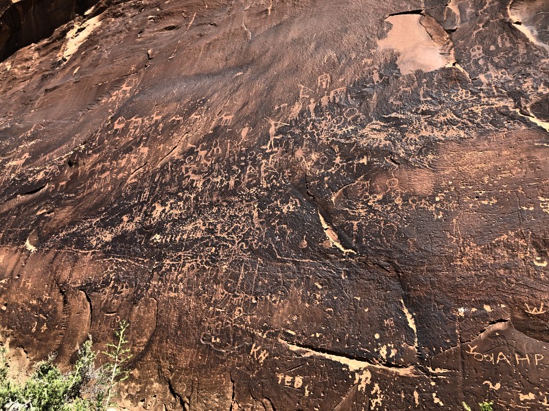
It turned out to be a sacred place. The rocky backdrop of the whole area was covered with ancient petroglyphs. I had never before seen such numerous glyphs with kokopellis, spirals, antelope and even quite alien-looking rock art. Officially, they are between 300 and 3,000 years old, but there is evidence that some of them have been there for over 6,000 years! To have hundreds of these images, in proximity to the river, means this was a place of significance to whom were probably the Anasazi, and also present-day Ute and Navajo nations.
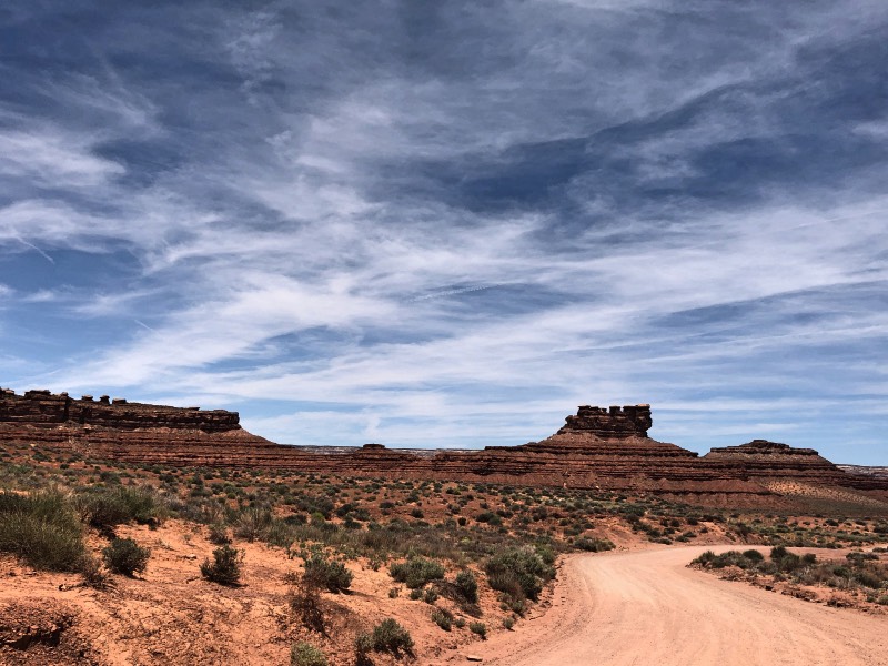
Sacred travels through Valley of the Gods
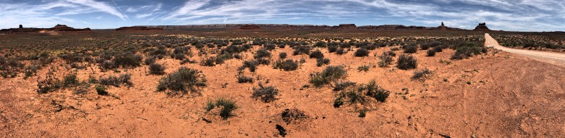
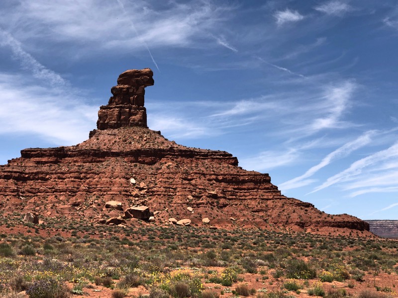
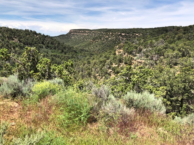
I saw “Valley of the Gods” on my road map, but until I drove through it, I had *no* idea just how special and how incredible it was. The sheer size, variety, scale and scope of the rock formations left me feeling a little like how you feel when you stand next to a massive building – you realize just how tiny you are. In the eons these rocks have existed, my life is a relative speck on the historical record. It took 250 million years for these rocks to fully form, what with their layers of sandstone, calcium, and siltstone. Over that time, water and wind carved them into the shapes they are now.
Massive Reverence
I was at once struck with reverent awe. More than any place so far, I felt the zing of sacred energy emanating from this place. It was truly breathtaking in a way that words cannot adequately describe. The landscape was desert red with rock pyres towering and contrasting with the bright blue sky. The shape and layered rock instantly made me marvel at nature’s perfect creative work.
The dirt road was 17 miles of twists and turns, featuring sagebrush bushes on the ground juxtaposed against the buttes and pinnacles. It was reminiscent of Monument Valley, which, while we were traveling all around these areas, we could see twenty miles distant. According to the Navajo, these rock formations are power places. With each significant pyre, the Navajo have a legend or a story. Yes, these lands sound silent, but if you listen, you can hear the voices of those who have gone before us.
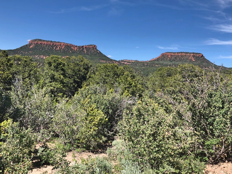
Bears Ears
Next on our journey was Bears Ears. Until we had found Sand Island, we didn’t know we’d be visiting this special place and knew that our proximity to it meant we had to visit. This area has been in the news in the US because former president Barack Obama designated Bears Ears as a national monument, citing its sacredness and archaeological significance. Nearby Native American communities and tribes celebrated these newly-designated 1.35 million acres of land – land in which they collaborated with the government to acquire.
The current president reduced this land area by 85%, opening the pathway for further uranium extraction. Lawsuits are currently in progress to retain the million acres. These lands are still sacred and in use by numerous tribes who need the whole area for their spiritual practices. This area includes places of significance, gravesites, and large amounts of archaeological and cultural remains.
The roads leading to Bears Ears were knuckle-whitening and jaw dropping to say the least. Heading out of Valley of the Gods, you take 261 toward Bears Ears. I have never been on a road quite like that. It effectively switches back and forth up a rock cliff. I don’t know what the elevation gain is, but you can gather from the 3D Google image that it’s at least several thousand feet. It’s a dirt road, no guardrails. If you can brave it, your reward is a view of Valley of the Gods and beyond. After that climb, there is another dirt road climb to get to the base of Bears Ears. It’s not as intense, but just as beautiful. The two rock formations really do look like a pair of bear ears.
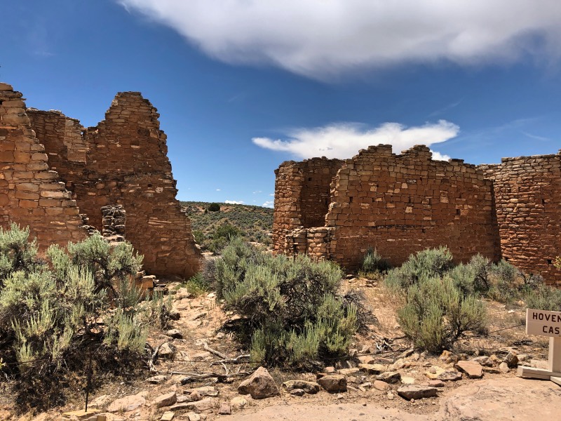
Sacred travels through Hovenweep
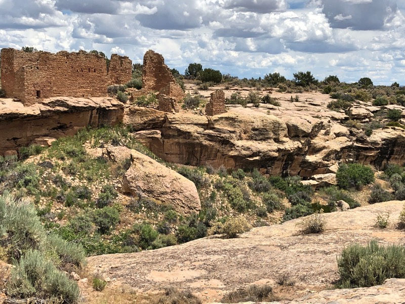
After a second night of camping at Sand Island, we headed to Hovenweep National Monument. This was also one of my favorite places. It wasn’t as “traveled” as Chaco, for example, and featured towers and dwellings along Little Ruin Canyon. You have to hike to these places and just as well: it helps to keep them preserved.
Hovenweep is home to the ancestral Pueblo people. What makes this place unusual and striking is that the structures don’t look entirely safe on some of the rocks. They might have interesting shapes or jut out in peculiar patterns. These ancestral people might have been trying to protect their water source or possibly tried to stay out of view from neighboring people. After these structures were built in the early 1200s, a severe drought likely hit the area. All over the region, historians surmise that lack of food and water drove different groups to attack each other, and by the late 1200s, the people had abandoned this area. I felt spirit here, as well. I think it was because I could sense in the silence a vibrant culture that once existed. A lot of thought went into building construction, use of materials, and respect for the environment. This was a place where ancient ceremonies celebrated births, deaths, and life’s milestones between.
Canyons of the Ancients
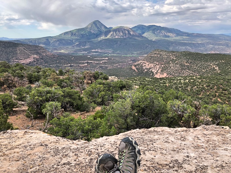
This was another spot on the map for which I can attribute the word, “incredible” – Canyons of the Ancients. After leaving Hovenweep, it was mid-afternoon. From experience, we knew it was time to figure out where we might camp for the night. If we didn’t have a place by early afternoon, it became high priority to find something. We drove along the southern portion of the Canyons. The southern part of the Sand Canyon Trailhead is beautiful, leading to a number of small ruins along the way. It is well-traveled and didn’t quite call to us.
We continued to the eastern part of the monument and found a dirt road to take us deeper into the Canyons. On more than one occasion I was glad we had an all-wheel-drive vehicle, and this was one instance. We knew there were some remote campsites atop a cliff overlooking the canyon. The road in was rocky and not well-traveled. After two miles of creeping along at no more than 5 mph, we summited the cliff and found a camp spot complete with beautiful vistas and landscapes. The only thing I would change is to be able to stay longer than just one night.
Sand Canyon Pueblo
In the morning we found a special place called Sand Canyon Pueblo. In the 80s, archaeologists excavated it to study, but then in the 90s they backfilled it to preserve it. Though there wasn’t much to see above ground, you could still sense the beauty and sacredness of the area. Sand Canyon had once been a hub of activity, and just about the same size as the renowned dwellings at Mesa Verde.
I, for one, am glad they backfilled the pueblo. It preserves it, yes. But it leaves room for imagination. And because it’s not well known, this area – perhaps more than any other I’d encountered on this trip – it invited contemplation. Even my partner thought so. We parted ways for much of our tour of the buried pueblo in favor of walking in silence, taking in the scenery, smelling the subtle scent of sagebrush, and meditating. This was another place where I felt particularly in touch with Spirit. Just knowing an awesome place of living, celebrating, & trading was beneath my feet by a people who lived in tandem with the earth and the elements, made my heart smile. Again, I could almost hear the echoes of their laughs, their whispers of dreams, their connection to the environment, the wisdom passed down through oral stories and art…I went within to my own breath to listen to the spirits….
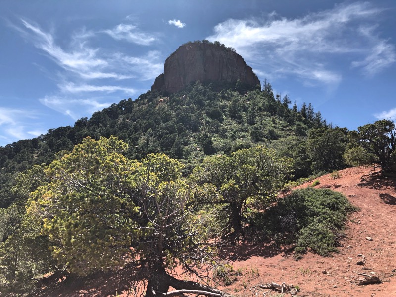
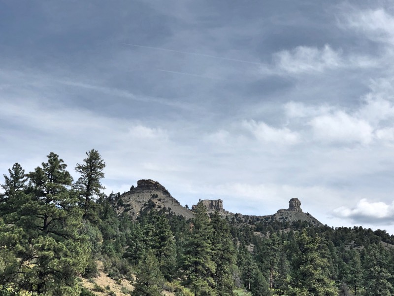
Chimney Rock
We hiked around Sand Canyon before continuing on through to Durango, CO and onto a place near Chimney Rock, where we found another camp spot along the Piedra River. All the rivers we’d seen were at capacity with choppy waters. Again, it made me think how “water is life” and yet it’s also so powerful in its persistence at carving canyons.
We were able to see Chimney Rock from a distance. Park officials only allowed guided tours to the top. I understood why: you reduce the impact of human activity, reduce erosion, and you get a great history lesson. Alas, we didn’t have time to do this and so admired the rock – and the unseen dwellings, kivas and rooms at the top – from the ground.
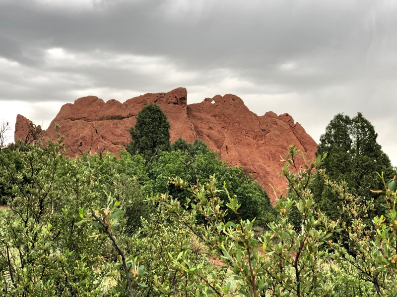
On to see family
The next leg of our trip took us to visit family. They also live in a sacred place: in Manitou Springs, and very close to Garden of the Gods. In another post, I’ll report more about those places. In the meantime, I’m planning our next road trip to find more sacred places: possibly going toward Wyoming, Montana, Idaho, and Washington.
Comments note:
Friends, I’m still catching up from all these incredible travels. I have visited most of your sites but I still need to respond to the ones here from the last week or two. Please bear with me as I get caught up. I have such deep gratitude for your comments and the community you help to build.
Aw, looked like a wonderful time traveling was spent. Glad you are back now. But also happy that you are looking to further your travel experiences more a bit during this summer. Hugs and Happy Monday now, my friend xoxo <3
Sweet Janine – Happy 4th! I hope you’ve had a great week so far. I had such a wonderful time traveling – I learned so much, felt so much, saw so much – it was incredible. 🙂 I’m also glad to be back. I love traveling and then I love coming home, too. 🙂
Sending you big hugs and wishes for a wonderful weekend, too! xo
Your trip sounds wonderful Cynthia! I loved your video and really enjoyed your photos, music, narration and pacing. Your joy and being drew me in for a guided meditation tour. Thank you.
Brad – thank you. I’m so glad you enjoyed the video – it took way too long, but I had so much fun creating it. It was a creative challenge, as well as a challenge to really set the tone for a mindful, sacred journey. It is a wonderful compliment to see that you felt like it was a guided meditation. 🙂 Have a great 4th and weekend!
It’s a part of the country I have little experience with. I have spent some time in Utah, but that’s it, really. I’m not big on hot and dry, but it is starkly beautiful, and I do understand its appeal. I’m glad you have a rewarding trip, Lil Sis. I’m just sad you didn’t swing north to my neck of the woods. 🙂 Hugs coming your way!
Big Bro – haha, you know, I can imagine the stark difference between the desert southwest and the Pacific northwest. It was entirely hot and dry, but – like you said – starkly beautiful. I am planning a trip to the northwest. It might be next summer or the one after. I’ll swing by your place, give you a hug and buy some eggs. 😉 We LOVE hardboiled eggs on these trips because they’re packable and easy to eat for breakfast. I hope you’re having a good week so far. Sending you hugs, happy 4th, and have a great weekend!
OK. Let me reiterate from Saturday night….wow! and how wonderful! What an incredible trip you guys had. Thank you for sharing 🙂
Sweet Denise – oh, those Saturday night call ins are entirely fun! It was a fun trip indeed. In the not-too-distant future, we’d like to go to the northeast again…and keep going to PEI and Nova Scotia…maybe Ontario…but we’ll have to swing by Clark’s house again and say hi! I’d better tell him in his comment below. Hehe.
Very cool.
(all sorts of compliments on the photography, especially the hand-held video but mostly the style)
Nicely done, yo
Hah! Thank you, Clark. I will take your compliments – I appreciate you. Ah, I’m so psyched you watched the video. Hehe. Yes…hand-held mostly because I was usually climbing on rocks, walking, my tripod was too hard to carry in certain places and well…I’m glad you liked it. lol.
I hope you have a happy 4th. I was just telling Denise that in the not-too-distant future, we want to return to the Northeast and then go to Prince Edward Island, Nova Scotia and some others…THAT would be very cool. 🙂
Oh, this is a fantastic Post.. I can see how you so enjoyed your spiritual connection to these places, You looked wonderful and energised full of joy in your smile..
So enjoyed your narration 🙂 and I learnt so much more about these places… Even the detours were meant to be.. 🙂
So loved your connection with Karen Pete.. and her healing feathers… WOW.. what talent.
Its only a short comment this evening, I am on a mission to catch up a little and have a long ways yet to go.. lol..
MUCH LOVE dearest Cynthia.. SO pleased you enjoyed your trip and wonderful to see ALL of your Photos here.. and LOVED your video <3 Thank you
Sweet Sue – I thought of you so often both on this trip and as I made the video: I kept thinking how you’d enjoy these forays into these beautiful native lands. It was moving and beautiful to do these travels. We definitely took some detours: the cave wasn’t planned, Valley of the Gods wasn’t planned, neither was Bears Ears or the cliff where we stayed right after we visited Hovenweep. And Karen’s artwork – yes! It was incredible to hear her speak and talk about her journey. Her sand painting now sits on my home altar.
And no worries about a “shorter” comment. Hehe. I know you have many comments to keep up with. I admire your tenacity for your ability to connect with all the beautiful people you do and not be online that much. You are a marvel at your ability to connect with people, my friend. Sending you lots of love, and thank you for watching the video. You are so sweet! 😘
Dear Cynthia,
I could get lost in each of these peaceful photographs. You have a way of taking us along on your sacred travels.
“Wisdom lines” indeed…LOL. This may be my new favorite expression. I loved reading about and seeing the talents of Karen Pete’s sand painting.
Thanks also for the seven days of guided meditations – right on time as I am on a semester break in a few days.
Wishing you lots of love, hugs and positive energy this Monday.
Love,
Maria
Sweet Mar – I love sharing about these sacred travels in the hopes that it inspires others, hehe. I love that you came along for this journey (at least through this post). I love wisdom lines. 🙂 I thought that when I first encountered Karen Pete and I intend to adopt it, too. And I’m so glad you like the meditations. I hope you have a wonderful, relaxing semester break. Take time to “just be,” and rest. Sending you love, positive energy, too. Thank you for your beautiful spirit. I always love when you get to come by. 😍😍😍
I hope your weekend is going well Cynthia, and big smiles that we both listen and watch learn while doing simple chores lol .. I often put my phone on video links and listen while ironing or knitting..
I have not picked that back up since our holiday return, We have decorated four rooms since our homecoming, not to mention catching up with the plot and garden, freezing ten pound of peas, lol..
So been very busy,
I crashed in the heat on Thursday 38C plus here, a new record for the UK.. We just melted, thank goodness we finished on Tuesday and spent Wednesday putting furniture back hanging pictures etc in new places in our revamp of dining room livingroom Hall stairs and landing..
Just the bedrooms and bathroom next.. ( But not for a few weeks lol ) we need to build up our strength again LOL
So just hopped back to reply, Glad the new softwear on your videos working well, and look forward to catching your posts back up, I am a little methodical at going through my comments, then working my way back to their blogs,
Usually I do it at the same time as I comment back, but I had 54 comments pending, and they had all been stood waiting long enough..
So today spent nearly all morning and afternoon just answering them..
So yes I do spend time, but I try to manage it with free time.. lol..
Sending Huge hugs your way Love Sue 🌈💜💚💙💕
Sweet Sue!
I hope you’ve had a good weekend and start to your week. Yes…listen and learn while doing other “low brainpower” tasks. lol. Decorating and working the garden all sound divine. I just had a long session with my journal and…there’s a part of me asking (rather loudly) to step back. I don’t know what that looks like for the website here per se, but there are LOTS of bricks in my driveway that need the cement knocked off of them so we can create a pathway in our yard, as well as fire pit. They’ve sat there over a year. The forest is whispering my name, telling me that I’ve been missed. Long weekends of camping and looking at the stars are a precious commodity. My mountain bike gathers dust and gently says, “we need a date.” I was realizing all this, this morning and am contemplating honoring these needs while still moving forward with my website here and balancing everything out, including my day job. Not an easy task. I did, however, love hearing about all the things you’re up to.
38C where you were, eh? Wow. That is quite warm. 100F. We all melt here, too, when it’s that hot. Those kinds of days make for nice napping and cool soups. I hope that heat relents soon, though. That kind of heat saps your energy – no matter how fit you are.
I’m enjoying this new software for my videos, hehe. And Photoshop for my artwork. It’s all so fun! Thank you for coming by and catching up. I always miss you when you’re gone, but I know you’re never too far for a virtual hug and smile. You had a lot of comments to answer. Whew! That takes some diligence and patience…
Sending you lots of love, big hugs, and gratitude that our paths have crossed – always. 🤗🙏🤗